Trio of Arches and Sunset
Your first stop in Moab should be Arches National Park, known for its over 2,000 natural stone arches. Bypass the crowded areas and make the 30-minute drive to Sand Dune Arch. Trudge through sand and pass between giant rock fins on this ultra-short hike. From there, cross the meadow and scramble under Broken Arch. For a longer hike, continue on to Tapestry Arch, which actually looks like three arches. As you get closer, you’ll see Tapestry is flanked by two false ones. Hustle back to your car and drive back to The Windows formation to see the dance between the last light of day and first shadows of nightfall. My favorite spot in the park to catch a sunset is under Double Arch. AAA / Jennifer Broome
Endless Canyon View
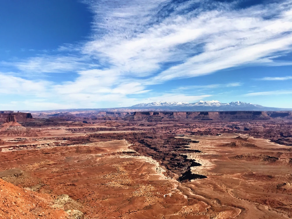
Island in the Sky is so vast it can be intimidating. Here’s how to navigate that section of Canyonlands National Park in about 6 hours including the 45-minute drive to and from Moab. Go to the southernmost point of the scenic drive to do the easy hike to Grand View Point. The landscape filled with endless canyons, buttes, mesas and spires carved by the Green and Colorado Rivers almost doesn’t seem real as you take it in from atop the giant mesa. Next make stops at the Buck Canyon and Green River overlooks. At the Aztec Butte, do what a ranger told me to do—go up the left one to see the ancient granaries. Your next short hike should be up about a half mile to get a view of the crater Upheaval Dome. Make Mesa Arch your final stop. Precariously perched on the cliff’s edge, it’s the perfect spot for a photo. You’ll easily end up hiking 4–5 miles for the day. AAA / Jennifer Broome
Sunrise at Delicate Arch
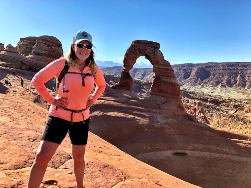
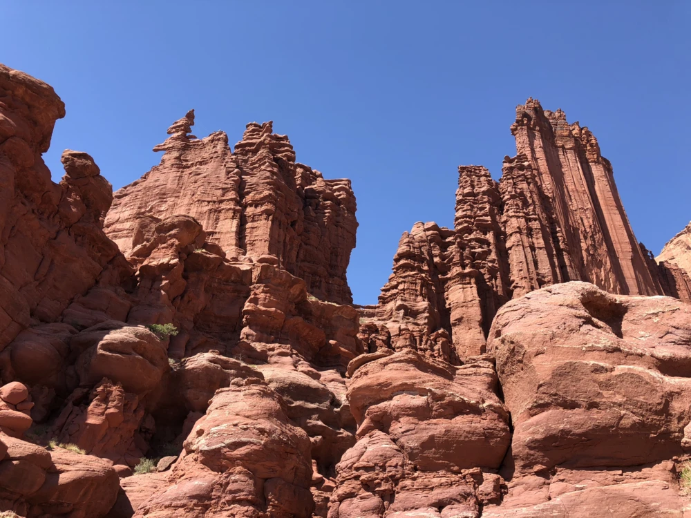
Delicate Arch is the most recognizable geological feature in the park and is the most popular hike in Arches. The best way to beat the crowds is to be on the trail no later than 7:30 a.m. Get up even earlier to catch sunrise over the iconic arch. If you want an up-close view of Delicate Arch, you have to do the 3-mile round-trip hike. The trail starts flat then quickly climbs as you hike on slickrock, which is smooth, weathered rock. You’ll want to wear hiking boots or shoes with good treads to grip the slick terrain. The trail meanders through an out-of-this-world landscape. Before you get to Delicate, you have to hike a narrow rock ledge for about 200 feet. If Delicate doesn’t take your breath away, that section of the hike will. When you get your first glimpse of Delicate Arch, enjoy a moment to just take it in. Standing under the arch is a must. As the sun comes up and the hues of the red sandstone take on a golden glow, you’ll be glad you got up to see the magical moment of sunrise at Delicate Arch. AAA / Jennifer BroomeIn Arches, if you’re up for some slickrock and crossing a 6-foot wide sandstone fin, then Double O Arch in Devils Garden is for you. The trail is easy to Landscape Arch, the longest arch in North America. You’ll have crowds to this point, but once you head straight up some slickrock, the crowds quickly dwindle. There’s some scrambling on this 4.2-mile round-trip hike, but the effort is worth it to see the Double O and vista views. It is easy to get turned around on the primitive trails so keep an eye out for cairns, which are rock mounds that mark the trail.On the way to Canyonlands, you pass Dead Horse Point State Park. It’s a detour worth taking to get the best panorama of the Colorado River and Canyonlands’ carved landscape. Legend is that cowboys used the narrow neck of the mesa top as a natural corral for wild mustangs. You can head straight out to the point overlook, but I’d suggest hiking the rim. Take East Rim Trail first, stop at the overlook, then continue on the West Rim Trail. You’ll likely enjoy solitude on the west side. When I hiked Fisher Towers, I felt like I had stepped into a Western movie. I couldn’t stop saying “wow,” at the soaring fins, spires, pinnacles and odd-shaped monstrous sandstone rock formations. A mile into the hike I reached the gigantic Titan formation. Most hikers stop there, but I continued on and enjoyed the serenity of having the rest of the trail virtually to myself. Once you get to the “Trail Ends” sign, relax and take in the view on this 5.2-mile round-trip trek.
Four Lesser Traveled Trails
For a hike with dinosaur tracks, petroglyphs (rock art), an arch and no crowds, the Longbow Arch hike is it. It’s only 2.4 miles round-trip and right off of SR 279. The tracks and petroglyphs are less than a quarter of a mile into the hike. Green dots lead the way on the slickrock as it changes from rugged to smooth mounds. You’ll make a turn and Longbow Arch comes into sight. Scramble up under the arch for a great view. AAA / Jennifer BroomeGrab a breakfast burrito and latte to go at Love Muffin Cafe, then find a spot to enjoy breakfast surrounded by Moab’s stunning scenery. If you’re taking a leisurely breakfast, is the place. The cozy and quirky café is a local favorite. Go for the “House Taters.” After adventuring all day, you’ll likely want a hearty meal for dinner. Eddie McStiff's is an institution in Moab. Their extensive menu includes steaks, Mexican food and even vegan selections. Try their authentic street tacos served with rice and cowboy beans or one of their specialty burgers. If you’re craving Italian food, Pasta Jay's is the spot for hearty comfort food. The pizza, spaghetti, rigatoni and ravioli are sure to send you into food coma bliss. Don’t worry about the carbs; you’ll easily work them off adventuring in Moab.